Quick Facts
About
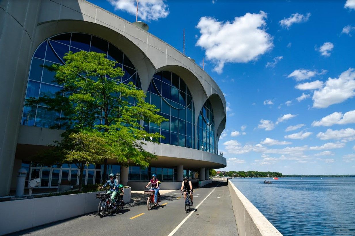
Consistently ranked one of the best places to live in America, Madison offers all the amenities of a large city without all the hassle. Not only is Madison the state capital and home to the state flagship university, it is a thriving and growing city that invests in talent, research, jobs, and culture. Nestled between two lakes, with a total of five lakes within the city’s vicinity, Madison is a naturally beautiful city with a variety of outdoor activities for every season. The city facilitates a range of cultural events year-round and takes advantage of its many parks for art, food, and musical festivals.
To learn more, please visit the City website here.
Projects
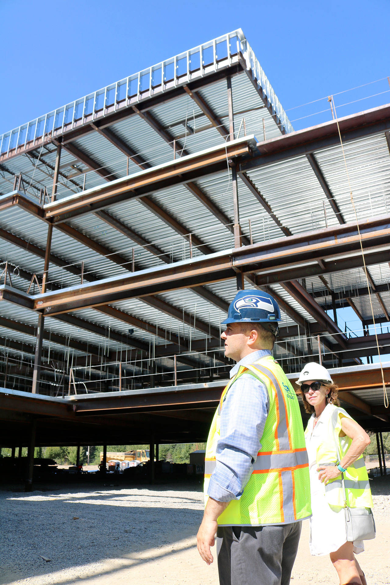
FY2024 Executive Capital Budget & Capital Improvement Plan Projects
The 2024 Executive Capital Budget and Capital Improvement Plan (CIP) invests in buildings, infrastructure, and other capital projects that make Madison a stronger, safer, and healthier community. The 2024 Executive CIP invests $1.5 billion in 164 projects and programs between 2024 and 2029, with $266.5 million scheduled for 2024.
As with prior years, the 2024 Capital Budget is aligned with the elements of a great city, outlined in the comprehensive plan, Imagine Madison:
- Land Use & Transportation
- Neighborhoods & Housing
- Economy & Opportunity
- Culture & Character
- Green & Resilient
- Effective Government
- Health & Safety
Please click here to view some of the major projects included in the 2024 Capital Improvement Plan.
Additionally, a list of all active and completed projects, as well as information regarding each project, can be found here.

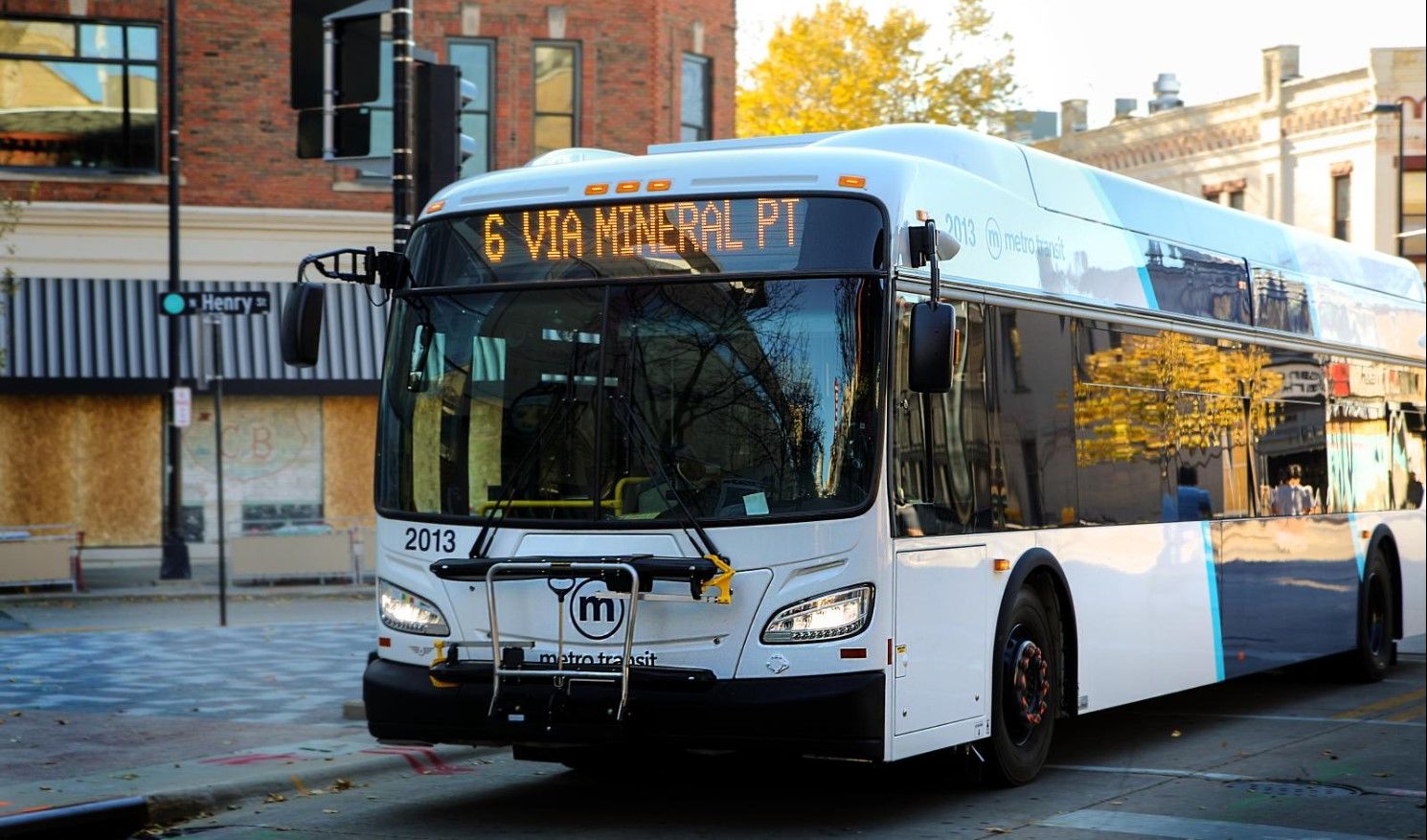
Bus Rapid Transit Project
Routes
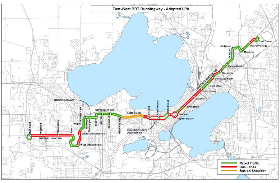
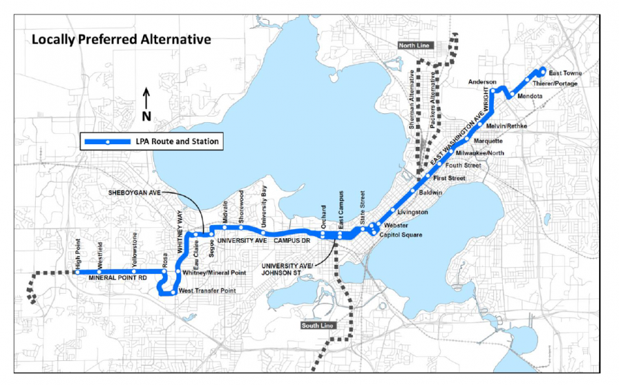
The East-West BRT system will include three separate service patterns, one of which, BRT C, will serve as a link between the North and South Transfer Points. This route will use BRT buses, operating as BRT from Park St. to First St., and as local service north and south of the BRT corridor, providing a bus every 15 minutes linking the two transfer points.
The East-West BRT budget includes funding to purchase the larger buses needed for the North/South BRT line, making the project easier to fund in the future.
BRT A – Runs east to west from East Town Mall to High Point Rd. mainly along East Washington Ave, University Ave, and Mineral Point Rd.
BRT B – Runs from the Capitol Square to Middleton using BRT infrastructure from the Capitol Square to Whitney Way.
BRT C – Runs from the South Transfer Point to the North Transfer Point using BRT infrastructure from Park St. to First St.
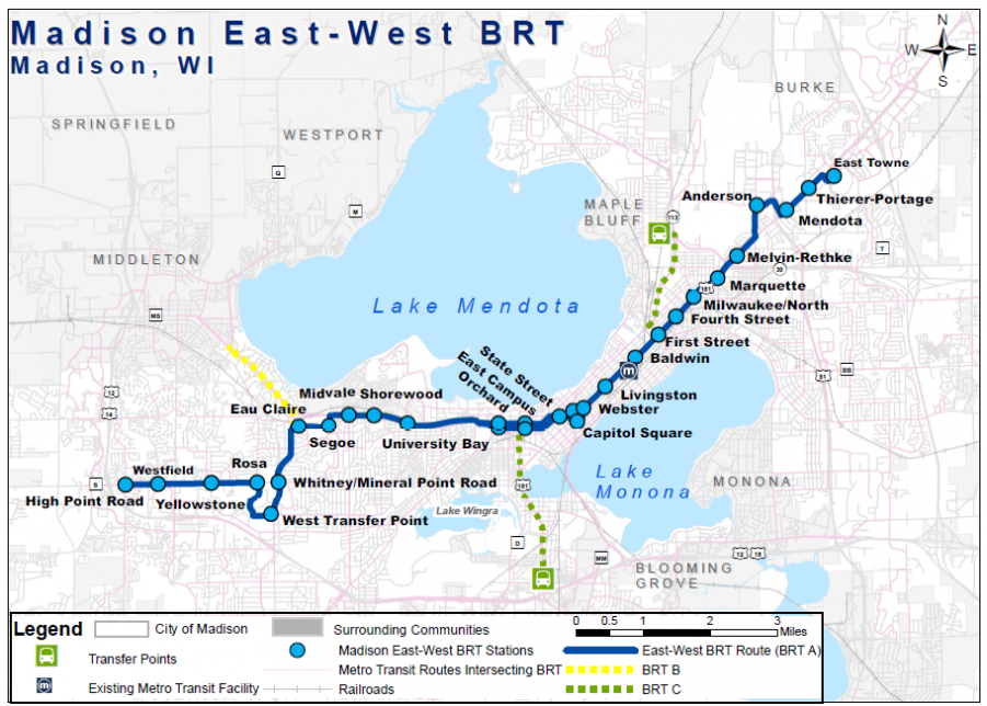
Routes Under Consideration
- Mendota St. Cut Off
- West Transfer Point/Rosa Rd.
Guideways
BRT will run in dedicated bus lanes, mixed traffic, and on the street shoulder. A portion of the line will run in new and existing dedicated bus lanes. For BRT running in mixed traffic, queue jumps and traffic signal controls will allow the BRT buses to move more quickly through traffic. Street shoulders will be used during heavy congestion along Campus Dr.
Guideways Under Consideration
- Center Running Way East Washington
- Center Running Way Mineral Point/Whitney Way
Station Locations
Refinements
There are a number of route, guideway and station location refinements under consideration. Final determinations will be made through the planning process in 2021.
Several refinements to the station locations are recommended:
- Added station at Big Sky
- Yellowstone station split into two – Grand Canyon and Island
- Whitney Way at Sheboygan station split into two – Eau Claire and Regent
- Webster and Livingston moved to Blair and Paterson
- Revised east terminal station locations on East Washington at Independence and East Springs
Station Features
The following will be featured at all BRT station locations.
- Level boarding
- Shelter
- Wind screen
- Seating
- Next bus arrival sign
- Emergency phone
- Audio push button
- Ticket vending
- Ticket validation
- Adjacent bike parking
Bus Features
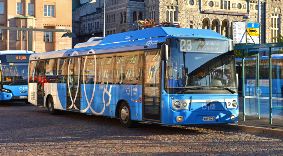
Vehicles will feature the following:
- 60 foot length to provide added capacity
- 100% electric
- Level boarding from platform or curb
- Boarding options (front & back)
- Bike storage
- Wi-Fi potential
Atwood Avenue
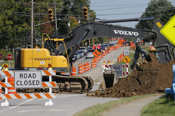
The proposed project includes pavement reconstruction, curb and gutter, existing sidewalk spot replacements and repairs, new multi-use path/sidewalk, Americans with Disabilities Act compliant curb ramps, storm sewer replacement, new street lighting, replacement of sanitary sewer and water main, new pavement marking, and new signs.
A portion of the street will have on-street bicycle accommodations as part of the project (see recent public mailer below). The exception being between Fair Oaks Avenue and Oakridge Avenue. Inbound cyclists have the opportunity of continuing on-street in a shared peak hour/parking lane or divert to the nearby Capital City Trail. Due to space constraints, outbound cyclists can either continue from the west on-street or utilize Fair Oaks Avenue on-street bike lanes to navigate to nearby adjacent routes including the Capital City Trail to connect into Atwood Avenue. A wider 7-foot wide sidewalk will be provided on the south side of Atwood Avenue within this segment to accommodate added pedestrian volume and small children with a destination of Lowell Elementary School. The north sidewalk of Atwood Avenue will have spot replacements to the 5-foot sidewalk.
The new bike path with adjacent sidewalk will primarily run parallel on the south sidewalk of Atwood Avenue and connect into Lakeland Avenue. The path will include a new pedestrian/bike bridge crossing over the Starkweather Creek parallel to the roadway bridge. New parking areas and street lighting are also included.
An 7-foot wide path will run along the north side of Atwood Avenue between Walter Street and Sugar Avenue to provide access to facilities including Olbrich Gardens and Olbrich Park. An additional 10-foot wide path will run along the north side of Atwood Avenue between Dennett Street and Walter Street to provide connectivity to the Capital City Trail.
Off-street bike facilities include a 10-foot wide path with an adjacent 5-foot wide sidewalk that extends along the south side of Atwood Avenue, between Oakridge Avenue and Dennett Street. On-street bike lanes will be provided from Dennett Drive to Cottage Grove Road. In addition, travel lanes are minimized from 11 feet to 10 feet at the intersection of Atwood Avenue and Cottage Grove Road in order to maintain the on-street bike lanes and sidewalks on both sides of the street without having large impacts to adjacent buildings and landscaping.
Garver Path
The City of Madison is proposing the construction of a new 2800-foot long pedestrian shared use path that would connect the existing Capital City Path at Sugar Avenue northward to Milwaukee Street. Three structural elements are proposed as part of the design including a bridge through the northern limits of the project, a bridge replacement at Ivy Street, and a new bridge crossing over Starkweather Creek.
University Avenue
University Ave is scheduled for reconstruction from Shorewood Boulevard/Hill St to University Bay Drive/Farley Ave. A map of the project limits can be found here: Project Limits PDF
The City of Madison is jointly participating with the Village of Shorewood Hills on the design and construction. The project includes reconstruction of pavement, curb & gutter, sidewalk as necessary, street lighting, traffic signals, water main, sanitary sewer and storm sewer. Design alternatives will include analysis to try and improve pedestrian & bicycle connectivity, bus rapid transit initiatives and stormwater drainage.
Sustainability Projects
Introduction
In September 2004, the “Building a Green Capital City: A Blueprint for Madison’s Sustainable Design and Energy Future” report was published. The “Blueprint,” as it came to be known, was developed through the effort of the Mayor’s Energy Task Force, a group formed in October of 2003, and charged with “making Madison a green capital city and creating a city that would be seen as a leader in energy efficiency and renewable energy that also supports the city’s economic vitality.”
Many of the recommendations of the “Blueprint” were implemented, particularly those that City government could implement and use to lead by example. Please see link.
In 2005, the City of Madison adopted The Natural Step (TNS) as its sustainability framework. The framework’s focus on systems thinking allowed discussions about Madison as a sustainable community to evolve beyond energy efficiency and renewable energy. In 2009, it became evident that the Blueprint needed to be updated and expanded. The Sustainable Design and Energy Committee (SDEC), formed in response to one of the recommendations in the“Blueprint”, took on the task of updating the report, with the assistance of a diverse group of stakeholders and experts.
The City continued its commitment to sustainability through the creation of the Quality and Sustainability Steering Committee in the fall of 2011, an executive staff team that provides ongoing attention to issues regarding quality and sustainability. This executive staff team provides sponsorship and support to various quality and sustainability improvement projects the City undertakes.
The SDEC’s name was changed to the Sustainable Madison Committee (SMC) by Council Resolution in 2012, so both of these acronyms will appear in this Plan.
Plan Structure and Overview
Madison’s improvement efforts in sustainability will focus on these three key areas (environment, economic prosperity and social well-being) with the goal of enhancing our community’s health and quality of life. To support the Plan and its implementation, the principles of the existing scientifically based sustainability framework, The Natural Step (TNS), will be utilized. The Natural Step framework has four System Conditions, or Sustainability Principles, that have been used when implementing change and improvement initiatives. The system conditions state that in a sustainable society, Nature is not subject to systematically increasing:
• concentrations of materials extracted from the Earth’s crust (e.g., fossil fuels, metals);
• concentrations of man-made substances (e.g., pesticides, solvents, herbicides);
• degradation by physical means (e.g., destruction of plant life, trees and water systems); or
• conditions that undermine people’s capacity to meet their needs (e.g., lack of quality daycare, lack of affordable housing, discriminatory practices).
Plan Purpose
The Sustainability Plan is meant to provide guidance for current and future decision makers, City employees, City committee members, residents and other entities. The strategies and associated actions outlined in the Plan are not meant to be prescriptive, but rather an attempt to lay out a series of priorities and directions that will help Madison and the capital area become more sustainable. The Plan is a document that should be used and modified as innovation brings new technologies, as new practices are developed or at such times that significant global events threaten to impact us.
The Sustainability Plan seeks to build community resilience in the face of such challenges as peak oil, climate change and economic crises. It is designed to engage our community to create an inspiring local way of life that can withstand the shocks of rapidly shifting global systems. Such challenges to global systems are likely to require that we regularly reassess our views and modify our responses.
Plan Structure
The Plan contains ten Sustainability Categories each of which contain a brief definition and vision created by committee and public input. Each category contains a number of strategies and has a non-exclusive list of actions associated with it. Key timeframes, funding sources, identified implementation leaders and/
or partners and additional benefits that the strategy can impact are also listed.
Timeframes are listed as short-term (1-3 years), medium-term (3-5 years) and long-term (more than 5 years). Some actions and strategies are very specific and ambitious, but others may appear more broadly stated. The SDEC/SMC and City agencies will work to create metrics where needed and to fine-tune strategies and actions as needs, technologies and stakeholders change. All the strategies require action and follow up if Madison is to provide stewardship of its resources for this and future generations.